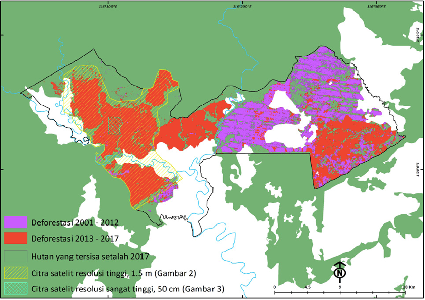
Satellite Imagery of PT Fajar Surya Swadaya in East Kalimantan
Source:
-
Land Cover 2000 and 2015. Can be seen on the website of the Ministry of Environment and Forestry.
-
Tree cover loss map by Hansen et al. 2013. "High-Resolution Global Maps of 21st-Century Forest Cover Change." Science 342 (November 15): 850–53; with updates until 2017.
Note:
Updated from previous release: (6 May 2018) Deforestasi di Konsesi PT Fajar Surya Swadaya (Djarum Group) Kalimantan Timur
Updated from previous release: (6 May 2018) Deforestasi di Konsesi PT Fajar Surya Swadaya (Djarum Group) Kalimantan Timur
Artikel Lainnya
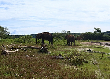
Entering the Elephant House

Javan rhino : conservation setbacks in ujung kulon national park (2023)
Jakarta, 11 April 2023 - Eighteen Javan rhinos (Rhinoceros sondaicus sondaicus) have disappeared in Ujung Kulon since 20...
New Analysis: Batang Toru Hydroelectric Plant Unnecessary
JAKARTA, 22 JANUARY 2020 — The Batang Toru Hydroelectric Power Plant (PLTA) built with a budget of USD 1.6 billion (equi...