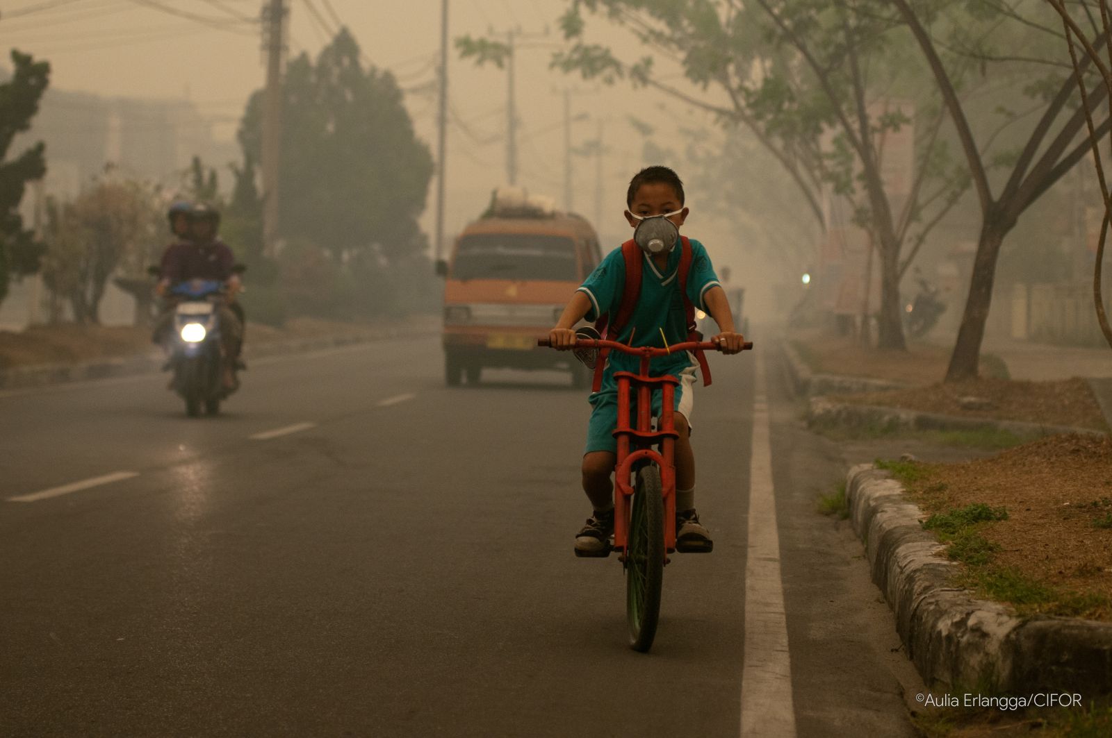
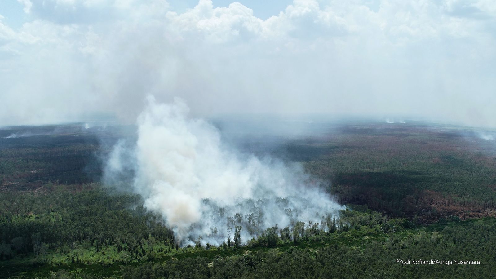
Jakarta, 29 September 2019—The devastating forest and peat fires did not end in 2015. Four years later, after the government spent trillions of rupiah in budgets to prevent and mitigate them, the fire disaster returned.
Auriga analyzed the distribution of 19,853 hotspots (hotspots) recorded by the NASA Fire Information for Resource Management System (FIRMS) in the period 1 August-28 September 2019. Hotspot data with a confidence level of more than 80%, or almost certainly as fire, was then overlay with maps of allocation and land use.
As a result, 85% of hotspots appeared in five provinces where fire is prone to fire, namely the largest in Central Kalimantan, West Kalimantan, Jambi, South Sumatra, and Riau respectively. Two-thirds of all hotspots, or 13,069 hotspots, are in forest areas. While the rest are in Other Use Areas (APL). This shows that the Ministry of Environment and Forestry (KLHK) is an institution that deserves to be held accountable for last year's forest fires.
Production forests dominate as forest areas with the most hotspots, namely 9,045 hotspots. Nearly half of this is in the concessions of companies that have permits for Industrial Plantation Forest (1,957 hotspots), Forest Concession Rights (1,597 hotspots), and plantations (1,061 hotspots). The rest is in production forests that are not burdened with permits (idle). This area is managed directly by the Ministry of Environment and Forestry so that this ministry should be responsible for the fires that occur on it.
Moreover, protected forests are not spared from hotspots, namely 2,201 hotspots. Even in conservation areas, which need special attention because they are equipped with a field management unit under the control of the Ministry of Environment and Forestry, 1,463 hotspots have been detected.
The results of the hotspot distribution overlay and the Peat Hydrological Unit (KHG) map show an equally tragic result. A total of 13,531 hotspots have appeared in this area. Most of the hotspots inside the KHG, again, are in forest areas. Even 11,558 hotspots are recorded in priority areas for peat restoration.
This raises public questions about the seriousness of the Ministry of Environment and Forestry in controlling forest and peat fires in Indonesia. Moreover, so far the Ministry of Environment and Forestry has not been transparent in disclosing restoration plans in forest areas. The Ministry of Environment and Forestry also closed public access to revised forestry company work plans / maps in priority areas for peat restoration.
The facts in this analysis are also increasingly worrying because the Ministry of Environment and Forestry has just issued a Regulation of the Minister of Environment and Forestry P.10 / 2019 concerning the Determination, Determination and Management of Peat Dome Peak. This regulation actually reduces protection against peat hydrology. On the other hand, exploitation on peatlands seems to be justified for expansion. The enabling conditions for peatland fires in the future are getting bigger.
In response to the results of the analysis, Auriga recommends that:
- The Ministry of Environment and Forestry created a fire hazard map in anticipation of recurring fire disasters in the dry season;
- The Ministry of Environment and Forestry restructured and repositioned the forest area management institutions to ensure that staff were located in forest areas, unlike currently most in Jakarta and provincial or district / city capitals;
- Ministry of Environment and Forestry revised Permen LHK P.10 / 2019 so that the management and protection of peat returns based on hydrological unity;
- The Ministry of Environment and Forestry opens public access to peat restoration in HTI, especially the revised General Work Plan and Annual Work Plan for HPH / HTI companies.
***
Contact person:
Syahrul Fitra (Communication Director of AURIGA) syahrul@auriga.or.id
Updated from previous release: (29 September 2019) Analisis Hotspot 1 Agustus s.d. 28 September 2019: Hotspot Kebanyakan Dalam Kawasan Hutan, Perlu Peta Rawan Kebakaran dan Saatnya Restrukturisasi KLHK
Artikel Lainnya
Entering the Elephant House

Javan rhino : conservation setbacks in ujung kulon national park (2023)
Jakarta, 11 April 2023 - Eighteen Javan rhinos (Rhinoceros sondaicus sondaicus) have disappeared in Ujung Kulon since 20...
New Analysis: Batang Toru Hydroelectric Plant Unnecessary
JAKARTA, 22 JANUARY 2020 — The Batang Toru Hydroelectric Power Plant (PLTA) built with a budget of USD 1.6 billion (equi...